Faidhle:Sierra Nevada map.png
Chan eil dùmhlachd-bhreacaidh nas fhearr ri fhaighinn.
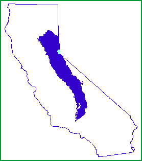
Sierra_Nevada_map.png (278 × 315 pixel, meud an fhaidhle: 5 KB, seòrsa MIME: image/png)

|
File:Sierra Nevada map vector.svg is a vector version of this file. It should be used in place of this PNG file when not inferior.
File:Sierra Nevada map.png → File:Sierra Nevada map vector.svg
For more information, see Help:SVG. |
 |
Gearr-chunntas
| Tuairisgeul | |
| Ceann-là | |
| Tùs | http://www.fs.fed.us/r5/spf/publications/fh_94-95/m261e.htm |
| Ùghdar | John W. Dale, U.S. Forest Service |
| Cead (Ag ath-chleachdadh an fhaidhle seo) |
Public Domain |
Ceadachadh
This image is a work of the Forest Service of the United States Department of Agriculture. As a work of the U.S. federal government, the image is in the public domain.
|
Eachdraidh an fhaidhle
Briog air ceann-là/àm gus am faidhle a shealltainn mar a nochd e aig an àm sin.
| Ceann-là/Àm | Dealbhag | Meud | Cleachdaiche | Beachd | |
|---|---|---|---|---|---|
| làithreach | 23:21, 7 dhen Fhaoilleach 2007 | | 278 × 315 (5 KB) | Hike395 | {{Information |Description=Map of the Sierra Nevada, United States |Source=http://www.fs.fed.us/r5/spf/publications/fh_94-95/m261e.htm |Date=1999-07-12 |Author=John W. Dale, U.S. Forest Service |Permission=Public Domain }} |
Cleachdadh an fhaidhle
Tha ceangal ris an fhaidhle seo san duilleag a leanas:
Cleachdadh fhaidhlichean uile-choitcheann
Tha na uicidhean eile a leanas a’ cleachdadh an fhaidhle seo
- Cleachdadh air af.wikipedia.org
- Cleachdadh air cs.wikipedia.org
- Cleachdadh air cy.wikipedia.org
- Cleachdadh air de.wikipedia.org
- Cleachdadh air en.wikipedia.org
- Cleachdadh air eo.wikipedia.org
- Cleachdadh air fi.wiktionary.org
- Cleachdadh air frr.wikipedia.org
- Cleachdadh air fy.wikipedia.org
- Cleachdadh air gl.wikipedia.org
- Cleachdadh air he.wikipedia.org
- Cleachdadh air hr.wikipedia.org
- Cleachdadh air id.wikipedia.org
- Cleachdadh air ja.wikipedia.org
- Cleachdadh air ko.wikipedia.org
- Cleachdadh air ml.wikipedia.org
- Cleachdadh air mr.wikipedia.org
- Cleachdadh air nn.wikipedia.org
- Cleachdadh air no.wikipedia.org
- Cleachdadh air pnb.wikipedia.org
- Cleachdadh air pt.wikipedia.org
- Cleachdadh air sco.wikipedia.org
- Cleachdadh air sh.wikipedia.org
- Cleachdadh air simple.wikipedia.org
- Cleachdadh air sk.wikipedia.org
- Cleachdadh air sl.wikipedia.org
- Cleachdadh air sr.wikipedia.org
- Cleachdadh air sv.wikipedia.org
- Cleachdadh air ta.wikipedia.org
- Cleachdadh air tr.wikipedia.org
- Cleachdadh air uk.wikipedia.org
- Cleachdadh air vi.wikipedia.org
- Cleachdadh air zh.wikipedia.org