Faidhle:Satellite image of Antigua And Barbuda in September 2002.jpg
Chan eil dùmhlachd-bhreacaidh nas fhearr ri fhaighinn.
Satellite_image_of_Antigua_And_Barbuda_in_September_2002.jpg (311 × 372 pixel, meud an fhaidhle: 16 KB, seòrsa MIME: image/jpeg)
Gearr-chunntas
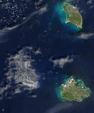
| Tuairisgeul | Cropped satellite image, showing the three islands of Antigua And Barbuda. |
| Ceann-là | |
| Tùs | Cropped from: http://visibleearth.nasa.gov/view_rec.php?id=4342 |
| Ùghdar | Jacques Descloitres, MODIS Rapid Response Team, NASA/GSFC |
Ceadachadh
| This file is in the public domain in the United States because it was solely created by NASA. NASA copyright policy states that "NASA material is not protected by copyright unless noted". (See Template:PD-USGov, NASA copyright policy page or JPL Image Use Policy.) | ||
 |
Warnings:
|
| Annotations | This image is annotated: View the annotations at Commons |
Eachdraidh an fhaidhle
Briog air ceann-là/àm gus am faidhle a shealltainn mar a nochd e aig an àm sin.
| Ceann-là/Àm | Dealbhag | Meud | Cleachdaiche | Beachd | |
|---|---|---|---|---|---|
| làithreach | 14:26, 18 dhen Dùbhlachd 2004 | | 311 × 372 (16 KB) | Hautala | {{PD-USGov-NASA}} Cropped satellite image, showing the three islands of Antigua And Barbuda. Original image taken from NASA's Visible Earth http://visibleearth.nasa.gov/cgi-bin/viewrecord?21888 |
Cleachdadh an fhaidhle
Tha ceangal ris an fhaidhle seo san duilleag a leanas:
Cleachdadh fhaidhlichean uile-choitcheann
Tha na uicidhean eile a leanas a’ cleachdadh an fhaidhle seo
- Cleachdadh air af.wikipedia.org
- Cleachdadh air arz.wikipedia.org
- Cleachdadh air ast.wikipedia.org
- Cleachdadh air azb.wikipedia.org
- Cleachdadh air ca.wikipedia.org
- Cleachdadh air cy.wikipedia.org
- Cleachdadh air de.wikivoyage.org
- Cleachdadh air diq.wikipedia.org
- Cleachdadh air el.wikipedia.org
- Cleachdadh air en.wikipedia.org
- Cleachdadh air eo.wikipedia.org
- Cleachdadh air fa.wikipedia.org
- Cleachdadh air fi.wikipedia.org
- Cleachdadh air fr.wikipedia.org
- Cleachdadh air ga.wikipedia.org
- Cleachdadh air gl.wikipedia.org
- Cleachdadh air ha.wikipedia.org
- Cleachdadh air hu.wikipedia.org
- Cleachdadh air ia.wikipedia.org
- Cleachdadh air io.wikipedia.org
- Cleachdadh air ja.wikipedia.org
- Cleachdadh air kab.wikipedia.org
- Cleachdadh air nl.wikipedia.org
- Cleachdadh air pcd.wikipedia.org
- Cleachdadh air pl.wikipedia.org
- Cleachdadh air pl.wiktionary.org
- Cleachdadh air ru.wikipedia.org
- Cleachdadh air sq.wikipedia.org
- Cleachdadh air uk.wikipedia.org
- Cleachdadh air vec.wikipedia.org
- Cleachdadh air www.wikidata.org