Faidhle:Porthloo beach, St Mary's, Scilly - geograph.org.uk - 1607577.jpg
Chan eil dùmhlachd-bhreacaidh nas fhearr ri fhaighinn.
Porthloo_beach,_St_Mary's,_Scilly_-_geograph.org.uk_-_1607577.jpg (640 × 383 pixel, meud an fhaidhle: 83 KB, seòrsa MIME: image/jpeg)
Gearr-chunntas
| Tuairisgeul |
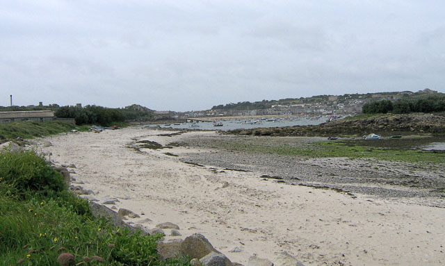
English: Porthloo beach, St Mary's, Scilly Porthloo has a nice sandy upper beach, but the middle shore is mainly occupied by shingle, rocks and weed. Not good for swimming, but from the seats nearby, you can watch shorebirds foraging amongst the rocks and weed. In the middle distance is the launching ramp for the St Mary's lifeboat at Carn Thomas. Beyond and to the right is St Mary's Pool, with many boats moored. The island to the middle right is Newford Island. The land to the upper right is the Garrison. |
| Ceann-là | |
| Tùs | From geograph.org.uk |
| Ùghdar | John Rostron |
| Urram (required by the license) | John Rostron / Porthloo beach, St Mary's, Scilly / |
| Camera location | | View this and other nearby images on: OpenStreetMap |
|---|
_heading:202.00&language=gd)
| Object location | | View this and other nearby images on: OpenStreetMap |
|---|
_heading:202.00&language=gd)
Ceadachadh

|
This image was taken from the Geograph project collection. See this photograph's page on the Geograph website for the photographer's contact details. The copyright on this image is owned by John Rostron and is licensed for reuse under the Creative Commons Attribution-ShareAlike 2.0 license.
|
This file is licensed under the Creative Commons Attribution-Share Alike 2.0 Generic license.
Urram: John Rostron
- Faodaidh tu:
- a cho-roinneadh – lethbhreac a dhèanamh dhen obair, a sgaoileadh is a tar-chur
- ath-mheasgachadh – an obair atharrachadh
- Fo bhuaidh nan cumhaichean a leanas:
- urram – Feumaidh tu iomradh a thoirt air an ùghdar no an neach aig a bheil cead air, dìreach mar a thoill iad (ach chan ann air dòigh a chuireas an sùilean dhaoine gu bheil iad ag aontachadh riut no ri d’ obair).
- co-roinneadh co-ionnann – Ma dh’atharraicheas tu no ma leasaicheas tu an obair seo, ’s urrainn an tionndadh ùr fon cheadachas seo no fo cheadachas coltach ris.
Eachdraidh an fhaidhle
Briog air ceann-là/àm gus am faidhle a shealltainn mar a nochd e aig an àm sin.
| Ceann-là/Àm | Dealbhag | Meud | Cleachdaiche | Beachd | |
|---|---|---|---|---|---|
| làithreach | 07:08, 4 dhen Mhàrt 2011 | | 640 × 383 (83 KB) | GeographBot | == {{int:filedesc}} == {{Information |description={{en|1=Porthloo beach, St Mary's, Scilly Porthloo has a nice sandy upper beach, but the middle shore is mainly occupied by shingle, rocks and weed. Not good for swimming, but from the seats nearby, you can |
Cleachdadh an fhaidhle
Tha ceangal ris an fhaidhle seo san duilleag a leanas:
Cleachdadh fhaidhlichean uile-choitcheann
Tha na uicidhean eile a leanas a’ cleachdadh an fhaidhle seo