Faidhle:Map of New York highlighting Monroe County.svg

Size of this PNG preview of this SVG file: 787 × 600 piogsail. Dùmhlachdan-breacaidh eile: 315 × 240 piogsail | 630 × 480 piogsail | 1,008 × 768 piogsail | 1,280 × 976 piogsail | 2,560 × 1,951 piogsail | 6,599 × 5,030 piogsail.
Am faidhle tùsail (Faidhle SVG, a-rèir ainm 6,599 × 5,030 pixel, meud faidhle: 112 KB)
Gearr-chunntas
| Tuairisgeul |
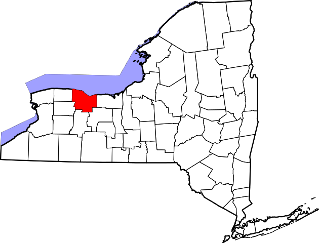
English: This is a locator map showing Monroe County in New York. For more information, see Commons:United States county locator maps. |
| Ceann-là | |
| Tùs |
M’ obair fhèin: English: The maps use data from nationalatlas.gov, specifically countyp020.tar.gz on the Raw Data Download page. The maps also use state outline data from statesp020.tar.gz. The Florida maps use hydrogm020.tar.gz to display Lake Okeechobee. |
| Ùghdar | David Benbennick |
Ceadachadh
| I, the copyright holder of this work, release this work into the public domain. This applies worldwide. In some countries this may not be legally possible; if so: I grant anyone the right to use this work for any purpose, without any conditions, unless such conditions are required by law. |
Eachdraidh an fhaidhle
Briog air ceann-là/àm gus am faidhle a shealltainn mar a nochd e aig an àm sin.
| Ceann-là/Àm | Dealbhag | Meud | Cleachdaiche | Beachd | |
|---|---|---|---|---|---|
| làithreach | 15:33, 12 dhen Ghearran 2006 | | 6,599 × 5,030 (112 KB) | David Benbennick | {{subst:User:Dbenbenn/clm|county=Monroe County|state=New York|type=county}} |
Cleachdadh an fhaidhle
Tha ceangal ris an fhaidhle seo san duilleag a leanas:
Cleachdadh fhaidhlichean uile-choitcheann
Tha na uicidhean eile a leanas a’ cleachdadh an fhaidhle seo
- Cleachdadh air ar.wikipedia.org
- مقاطعة مونرو (نيويورك)
- فيربورت
- آيرونديكويت
- روتشستر (نيويورك)
- هونوي فالس (نيويورك)
- إيست روتشستر (نيويورك)
- بروكبورت (نيويورك)
- تشورتشفيل (نيويورك)
- هيلتون (نيويورك)
- سكوتفيل (نيويورك)
- سبنسربورت (نيويورك)
- قرية بيتسفورد (نيويورك)
- قرية ويبستر (نيويورك)
- تشيلي (نيويورك)
- كلاركسون (نيويورك)
- غيتس (نيويورك)
- غريس (نيويورك)
- هاملين (نيويورك)
- هنريتا (نيويورك)
- ميندون (نيويورك)
- أوغدين (نيويورك)
- بارما (نيويورك)
- بينفيلد (نيويورك)
- بيرينتون (نيويورك)
- معهد روشيستر للتكنولوجيا
- قالب:مقاطعة مونرو (نيويورك)
- Cleachdadh air azb.wikipedia.org
- Cleachdadh air bg.wikipedia.org
- Cleachdadh air bpy.wikipedia.org
- Cleachdadh air ca.wikipedia.org
- Cleachdadh air cdo.wikipedia.org
- Cleachdadh air ceb.wikipedia.org
- Cleachdadh air ce.wikipedia.org
- Cleachdadh air cs.wikipedia.org
- Cleachdadh air cy.wikipedia.org
- Cleachdadh air de.wikipedia.org
- Cleachdadh air el.wikipedia.org
- Cleachdadh air en.wikipedia.org
Seall an corr dhen chleachdadh uile-choitcheann a nithear dhen fhaidhle seo.