Faidhle:Island I Vow - geograph.org.uk - 1041594.jpg
Chan eil dùmhlachd-bhreacaidh nas fhearr ri fhaighinn.
Island_I_Vow_-_geograph.org.uk_-_1041594.jpg (640 × 480 pixel, meud an fhaidhle: 82 KB, seòrsa MIME: image/jpeg)
Gearr-chunntas
| Tuairisgeul |
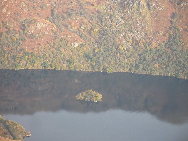
English: Island I Vow A small wooded island in the middle of the narrow upper Loch Lomond, which is quite an unusual place for an island, narrow lochs with steep sides are usually deep, as Loch Lomond is near here. The island was once home to a castle, inhabited up to the 18th century and was a stronghold of the notorious MacFarlanes. Today a single yellow kayak, was moored on its southern shore
Beyond the island, the slopes of Beinn a' Choin plunge deeply into the loch, heightening the mystery of the island. View from the Little Hills of Ben Vorlich. |
| Ceann-là | |
| Tùs | From geograph.org.uk |
| Ùghdar | Richard Webb |
| Urram (required by the license) | Richard Webb / Island I Vow / |
| Camera location | | View this and other nearby images on: OpenStreetMap |
|---|
_heading:90.00&language=gd)
| Object location | | View this and other nearby images on: OpenStreetMap |
|---|
_heading:90.00&language=gd)
Ceadachadh

|
This image was taken from the Geograph project collection. See this photograph's page on the Geograph website for the photographer's contact details. The copyright on this image is owned by Richard Webb and is licensed for reuse under the Creative Commons Attribution-ShareAlike 2.0 license.
|
This file is licensed under the Creative Commons Attribution-Share Alike 2.0 Generic license.
Urram: Richard Webb
- Faodaidh tu:
- a cho-roinneadh – lethbhreac a dhèanamh dhen obair, a sgaoileadh is a tar-chur
- ath-mheasgachadh – an obair atharrachadh
- Fo bhuaidh nan cumhaichean a leanas:
- urram – Feumaidh tu iomradh a thoirt air an ùghdar no an neach aig a bheil cead air, dìreach mar a thoill iad (ach chan ann air dòigh a chuireas an sùilean dhaoine gu bheil iad ag aontachadh riut no ri d’ obair).
- co-roinneadh co-ionnann – Ma dh’atharraicheas tu no ma leasaicheas tu an obair seo, ’s urrainn an tionndadh ùr fon cheadachas seo no fo cheadachas coltach ris.
Eachdraidh an fhaidhle
Briog air ceann-là/àm gus am faidhle a shealltainn mar a nochd e aig an àm sin.
| Ceann-là/Àm | Dealbhag | Meud | Cleachdaiche | Beachd | |
|---|---|---|---|---|---|
| làithreach | 21:35, 23 dhen Ghearran 2011 | | 640 × 480 (82 KB) | GeographBot | == {{int:filedesc}} == {{Information |description={{en|1=Island I Vow A small wooded island in the middle of the narrow upper Loch Lomond, which is quite an unusual place for an island, narrow lochs with steep sides are usually deep, as Loch Lomond is nea |
Cleachdadh an fhaidhle
Tha ceangal ris an fhaidhle seo san duilleag a leanas:
Cleachdadh fhaidhlichean uile-choitcheann
Tha na uicidhean eile a leanas a’ cleachdadh an fhaidhle seo
- Cleachdadh air da.wikipedia.org
- Cleachdadh air en.wikipedia.org
- Cleachdadh air ga.wikipedia.org
- Cleachdadh air www.wikidata.org