Faidhle:Eritrea Map.jpg
Meud an ro-sheallaidh seo: 527 × 600 piogsail. Dùmhlachdan-breacaidh eile: 211 × 240 piogsail | 422 × 480 piogsail | 675 × 768 piogsail | 1,046 × 1,190 piogsail.
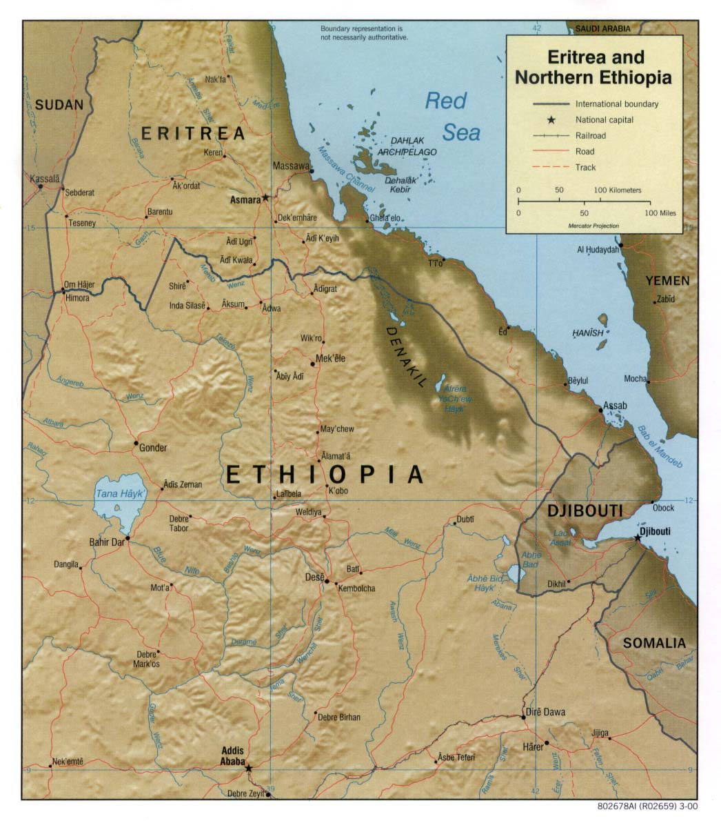
Am faidhle tùsail (1,046 × 1,190 pixel, meud an fhaidhle: 184 KB, seòrsa MIME: image/jpeg)
| Tuairisgeul | Shaded relief map of Eritrea. | |||
| Ceann-là | ||||
| Tùs | [1] from the Perry-Castañeda Library Map Collection. | |||
| Ùghdar | CIA | |||
| Cead (Ag ath-chleachdadh an fhaidhle seo) |
|
|||
| Other versions |


![[1]](http://www.lib.utexas.edu/maps/africa/eritrea_ethiopia_rel2000.jpg)
Eachdraidh an fhaidhle
Briog air ceann-là/àm gus am faidhle a shealltainn mar a nochd e aig an àm sin.
| Ceann-là/Àm | Dealbhag | Meud | Cleachdaiche | Beachd | |
|---|---|---|---|---|---|
| làithreach | 11:20, 22 dhen Ghearran 2006 | | 1,046 × 1,190 (184 KB) | Lupo | Shaded relief map of Eritrea. Source: [http://www.lib.utexas.edu/maps/africa/eritrea_ethiopia_rel2000.jpg] from the [http://www.lib.utexas.edu/maps/eritrea.html Perry-Castañeda Library Map Collection]. {{PD-USGov-CIA}} Category:Maps of Eritrea |
Cleachdadh an fhaidhle
Tha ceangal ris an fhaidhle seo san duilleag a leanas:
Cleachdadh fhaidhlichean uile-choitcheann
Tha na uicidhean eile a leanas a’ cleachdadh an fhaidhle seo
- Cleachdadh air bn.wikipedia.org
- Cleachdadh air ca.wikipedia.org
- Cleachdadh air ckb.wikipedia.org
- Cleachdadh air de.wikipedia.org
- Cleachdadh air en.wikipedia.org
- Cleachdadh air fa.wikipedia.org
- Cleachdadh air hr.wiktionary.org
- Cleachdadh air id.wikipedia.org
- Cleachdadh air it.wikipedia.org
- Cleachdadh air it.wikibooks.org
- Cleachdadh air ka.wikipedia.org
- Cleachdadh air mzn.wikipedia.org
- Cleachdadh air nl.wikipedia.org
- Cleachdadh air pl.wikipedia.org
- Cleachdadh air ru.wikipedia.org
- Cleachdadh air uk.wikipedia.org
- Cleachdadh air www.wikidata.org