Faidhle:Châtenay-Malabry map.svg

Size of this PNG preview of this SVG file: 587 × 600 piogsail. Dùmhlachdan-breacaidh eile: 235 × 240 piogsail | 470 × 480 piogsail | 752 × 768 piogsail | 1,002 × 1,024 piogsail | 2,004 × 2,048 piogsail | 1,552 × 1,586 piogsail.
Am faidhle tùsail (Faidhle SVG, a-rèir ainm 1,552 × 1,586 pixel, meud faidhle: 540 KB)
Gearr-chunntas
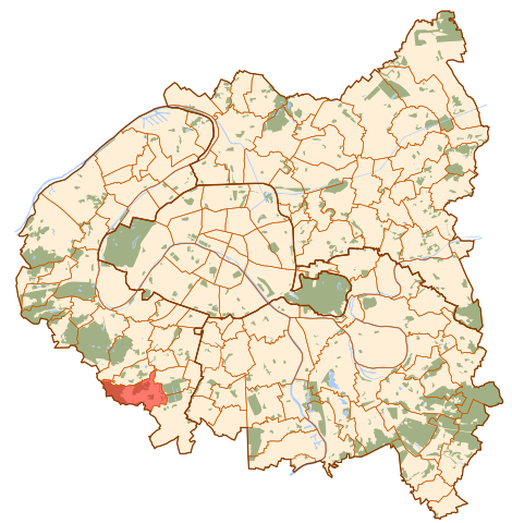
| Tuairisgeul | Map of Paris and its inner ring départements, localization of Châtenay-Malabry (Author: Metropolitan). |
| Ceann-là | 10 dhen Dàmhair 2006 (original upload date) |
| Tùs | No machine-readable source provided. Own work assumed (based on copyright claims). |
| Ùghdar | No machine-readable author provided. Metropolitan~commonswiki assumed (based on copyright claims). |
Ceadachadh
| I, the copyright holder of this work, release this work into the public domain. This applies worldwide. In some countries this may not be legally possible; if so: I grant anyone the right to use this work for any purpose, without any conditions, unless such conditions are required by law. |
Eachdraidh an fhaidhle
Briog air ceann-là/àm gus am faidhle a shealltainn mar a nochd e aig an àm sin.
| Ceann-là/Àm | Dealbhag | Meud | Cleachdaiche | Beachd | |
|---|---|---|---|---|---|
| làithreach | 11:59, 10 dhen Dàmhair 2006 | | 1,552 × 1,586 (540 KB) | Metropolitan~commonswiki | Map of Paris and its inner ring départements, localization of Châtenay-Malabry (Author: Metropolitan). Category:Locator maps for municipalities of Hauts-de-Seine |
Cleachdadh an fhaidhle
Tha ceangal ris an fhaidhle seo san duilleag a leanas:
Cleachdadh fhaidhlichean uile-choitcheann
Tha na uicidhean eile a leanas a’ cleachdadh an fhaidhle seo
- Cleachdadh air ar.wikipedia.org
- Cleachdadh air arz.wikipedia.org
- Cleachdadh air ast.wikipedia.org
- Cleachdadh air ca.wikipedia.org
- Cleachdadh air en.wikipedia.org
- Cleachdadh air eo.wikipedia.org
- Cleachdadh air es.wikipedia.org
- Cleachdadh air eu.wikipedia.org
- Cleachdadh air fa.wikipedia.org
- Cleachdadh air fi.wikipedia.org
- Cleachdadh air fr.wikipedia.org
- Cleachdadh air id.wikipedia.org
- Cleachdadh air ja.wikipedia.org
- Cleachdadh air kab.wikipedia.org
- Cleachdadh air la.wikipedia.org
- Cleachdadh air mk.wikipedia.org
- Cleachdadh air ms.wikipedia.org
- Cleachdadh air no.wikipedia.org
- Cleachdadh air pl.wikipedia.org
- Cleachdadh air ro.wikipedia.org
- Cleachdadh air sq.wikipedia.org
- Cleachdadh air tr.wikipedia.org
- Cleachdadh air tt.wikipedia.org
- Cleachdadh air www.wikidata.org