Faidhle:Caithness UK location map.svg

Size of this PNG preview of this SVG file: 519 × 599 piogsail. Dùmhlachdan-breacaidh eile: 208 × 240 piogsail | 416 × 480 piogsail | 665 × 768 piogsail | 887 × 1,024 piogsail | 1,773 × 2,048 piogsail | 1,233 × 1,424 piogsail.
Am faidhle tùsail (Faidhle SVG, a-rèir ainm 1,233 × 1,424 pixel, meud faidhle: 1.29 MB)
| Tuairisgeul |
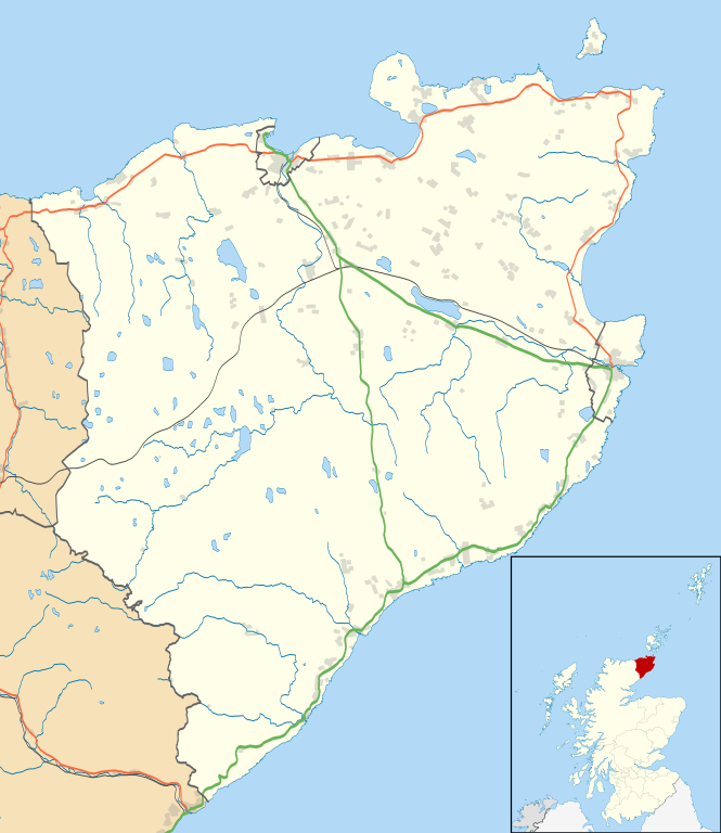
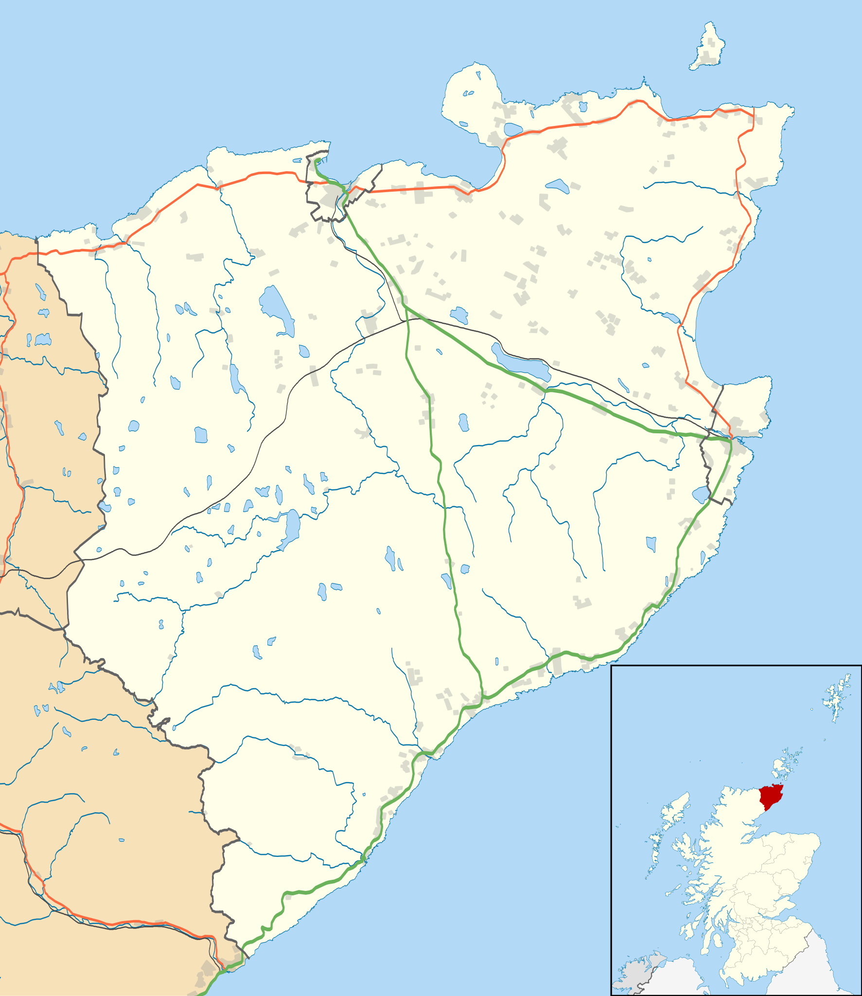
Blank map of the Caithness ward management area, UK in 2011, with the following information shown:
Equirectangular map projection on WGS 84 datum, with N/S stretched 180% Geographic limits:
|
| Ceann-là | |
| Tùs |
|
| Ùghdar | Nilfanion, created using Ordnance Survey data |
| Cead (Ag ath-chleachdadh an fhaidhle seo) |
Tha am faidhle seo fo cheadachas Creative Commons Attribution-Share Alike 3.0 Unported. Urram: Contains Ordnance Survey data © Crown copyright and database right
|
| Other versions | File:Caithness UK blank map.svg - Blank map |
Eachdraidh an fhaidhle
Briog air ceann-là/àm gus am faidhle a shealltainn mar a nochd e aig an àm sin.
| Ceann-là/Àm | Dealbhag | Meud | Cleachdaiche | Beachd | |
|---|---|---|---|---|---|
| làithreach | 11:11, 10 dhen Ghearran 2011 | | 1,233 × 1,424 (1.29 MB) | Nilfanion | {{Information |Description=Blank map of the Caithness ward management area, UK in 2011, with the following information shown: *Ward boundaries *Coastline, lakes and rivers *Roads and railways *Urban areas Equirectangular map projection on |
Cleachdadh an fhaidhle
Tha ceangal ris an fhaidhle seo san duilleag a leanas:
Cleachdadh fhaidhlichean uile-choitcheann
Tha na uicidhean eile a leanas a’ cleachdadh an fhaidhle seo
- Cleachdadh air ar.wikipedia.org
- Cleachdadh air ceb.wikipedia.org
- Cleachdadh air en.wikipedia.org
- Castle of Mey
- Thurso
- Halkirk
- Latheronwheel
- Castletown, Highland
- Haster
- Dunnet
- Latheron
- Caithness General Hospital
- Georgemas
- Reay
- Watten, Highland
- Altnabreac
- Achreamie
- Ackergill
- Skarfskerry
- Lybster
- Nybster
- Fresgoe
- Dunbeath
- Scrabster
- Ackergill Tower
- Bilbster
- Borgue, Highland
- Staxigoe
- Brabsterdorran
- Braemore
- Broubster
- Ulbster
- Bower, Highland
- Gillock
- Freswick
- Thrumster, Caithness
- Ham, Caithness
- Huna, Caithness
- Whaligoe
- Auckengill
- Achvarasdal
- Achingills
- Bruan
- Buldoo
- Balnabruich
- Papigoe
- Houstry
- Keiss
- Swiney
- Dorrery
Seall an corr dhen chleachdadh uile-choitcheann a nithear dhen fhaidhle seo.