Faidhle:Habsburg Map 1547.jpg
Am faidhle tùsail (1,654 × 1,029 pixel, meud an fhaidhle: 534 KB, seòrsa MIME: image/jpeg)
Gearr-chunntas
| Tuairisgeul |
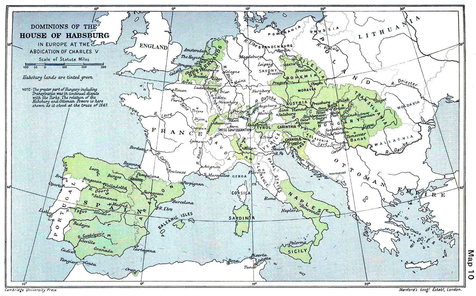
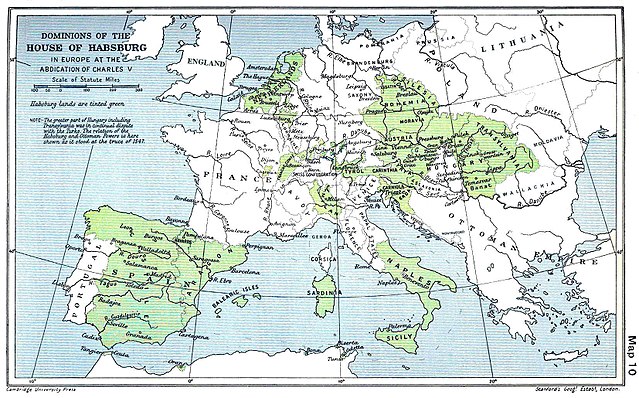
English: A map of the dominion of the Habsburgs following the Battle of Mühlberg (1547) |
| Ceann-là | |
| Tùs |
The Cambridge Modern History Atlas, edited by Sir Adolphus William Ward, G.W. Prothero, Sir Stanley Mordaunt Leathes, and E.A. Benians. Cambridge University Press: London, 1912. Editors were Sir Adolphus William Ward (†1924), G.W. Prothero (†1922), and Sir Stanley Mordaunt Leathes (†1938). Individual authors of works making up the atlas are not identified, nor are the likely to be, after reasonable research. |
| Ùghdar | edited by Sir Adolphus William Ward, G.W. Prothero, Sir Stanley Mordaunt Leathes |
| Other versions |
|

Ceadachadh
This work is in the public domain in the United States because it was published (or registered with the U.S. Copyright Office) before January 1, 1929.
Public domain works must be out of copyright in both the United States and in the source country of the work in order to be hosted on the Commons. If the work is not a U.S. work, the file must have an additional copyright tag indicating the copyright status in the source country.
Note: This tag should not be used for sound recordings. |
This UK artistic or literary work, of which the author is unknown and cannot be ascertained by reasonable enquiry, is in the public domain because it is one of the following:
|
 |
Eachdraidh an fhaidhle
Briog air ceann-là/àm gus am faidhle a shealltainn mar a nochd e aig an àm sin.
| Ceann-là/Àm | Dealbhag | Meud | Cleachdaiche | Beachd | |
|---|---|---|---|---|---|
| làithreach | 09:20, 29 dhen Mhàrt 2018 | | 1,654 × 1,029 (534 KB) | Trecătorul răcit | Little add: borders of the time |
| 11:01, 3 dhen t-Sultain 2015 |  | 1,654 × 1,029 (518 KB) | Kurzon | Reverted to version as of 17:22, 9 August 2010 | |
| 11:01, 3 dhen t-Sultain 2015 |  | 1,654 × 1,029 (518 KB) | Kurzon | Reverted to version as of 17:22, 9 August 2010 | |
| 21:33, 29 dhen Ògmhios 2013 |  | 1,654 × 1,029 (546 KB) | CSvBibra | add more contrast per request by another user | |
| 17:22, 9 dhen Lùnastal 2010 |  | 1,654 × 1,029 (518 KB) | CSvBibra | Previously put cleaned up version in new file with "b" after name. Now updating original file with "b" version. Both files uses throughout Wikipedias | |
| 09:07, 28 dhen Lùnastal 2008 |  | 1,654 × 1,029 (649 KB) | F l a n k e r | Wrap, shadows and minor improvements | |
| 14:42, 28 dhen Ògmhios 2005 |  | 1,654 × 1,029 (421 KB) | Rythin~commonswiki | A map of the dominion of the Habsburgs following the Battle of Mühlberg (1547). Taken from ''The Cambridge Modern History Atlas,'' edited by Sir Adolphus William Ward, G.W. Prothero, Sir Stanley Mordaunt Leathes, and E.A. Benians. Cambridge University Pr |
Cleachdadh an fhaidhle
Tha ceangal ris an fhaidhle seo san duilleag a leanas:
Cleachdadh fhaidhlichean uile-choitcheann
Tha na uicidhean eile a leanas a’ cleachdadh an fhaidhle seo
- Cleachdadh air af.wikipedia.org
- Cleachdadh air an.wikipedia.org
- Cleachdadh air ar.wikipedia.org
- Cleachdadh air arz.wikipedia.org
- Cleachdadh air ast.wikipedia.org
- Cleachdadh air azb.wikipedia.org
- Cleachdadh air ba.wikipedia.org
- Cleachdadh air be.wikipedia.org
- Cleachdadh air bg.wikipedia.org
- Cleachdadh air br.wikipedia.org
- Cleachdadh air bs.wikipedia.org
- Cleachdadh air ca.wikipedia.org
- Cleachdadh air cs.wikipedia.org
- Cleachdadh air da.wikipedia.org
- Cleachdadh air de.wikipedia.org
- Cleachdadh air el.wikipedia.org
Seall an corr dhen chleachdadh uile-choitcheann a nithear dhen fhaidhle seo.